
At a late stage of development, even large and densely drilled fields may retain undetected potential. In this project, for one of the multi-layer Jurassic targets in Western Kazakhstan, the task of searching for bypassed prospective zones was solved by integrating conventional geological and geophysical analysis with machine learning methods. The study relied on a very dense dataset: more than 5,000 wells, core, well logs, and 3D seismic data.
The key technology in this work was classification of gamma ray and spontaneous potential logs using three-dimensional Kohonen neural networks. Unlike conventional discrete classification, this approach not only separates data into classes but also preserves the degree of similarity between them. This is especially important in facies analysis, where transitions between lithotypes and depositional environments are often gradual.
RGB visualization was used to display the classification results, with three indices of the Kohonen space encoded through the mixing of red, green, and blue channels. This approach makes multidimensional relationships between objects visually intuitive: classes with similar properties are shown in similar shades, while contrasting facies differences are immediately highlighted by color. As a result, classification becomes more than a formal machine learning step; it becomes a practical tool for geological interpretation and mapping of facies transitions.
The classification results were integrated with seismic attributes and porosity cubes. Joint analysis of these data made it possible to delineate sand body outlines, trace the sequence of their formation, and refine the depositional model of the target interval.
Practical takeaways
New prospective targets for further development were identified within the studied interval. Two of them were interpreted as isolated sand bodies of anastomosing fluvial systems, laterally replaced by clayey floodplain deposits and overlain by a transgressive clay interval. This geometry and facies isolation make them candidates for bypassed reservoirs in a mature field setting.
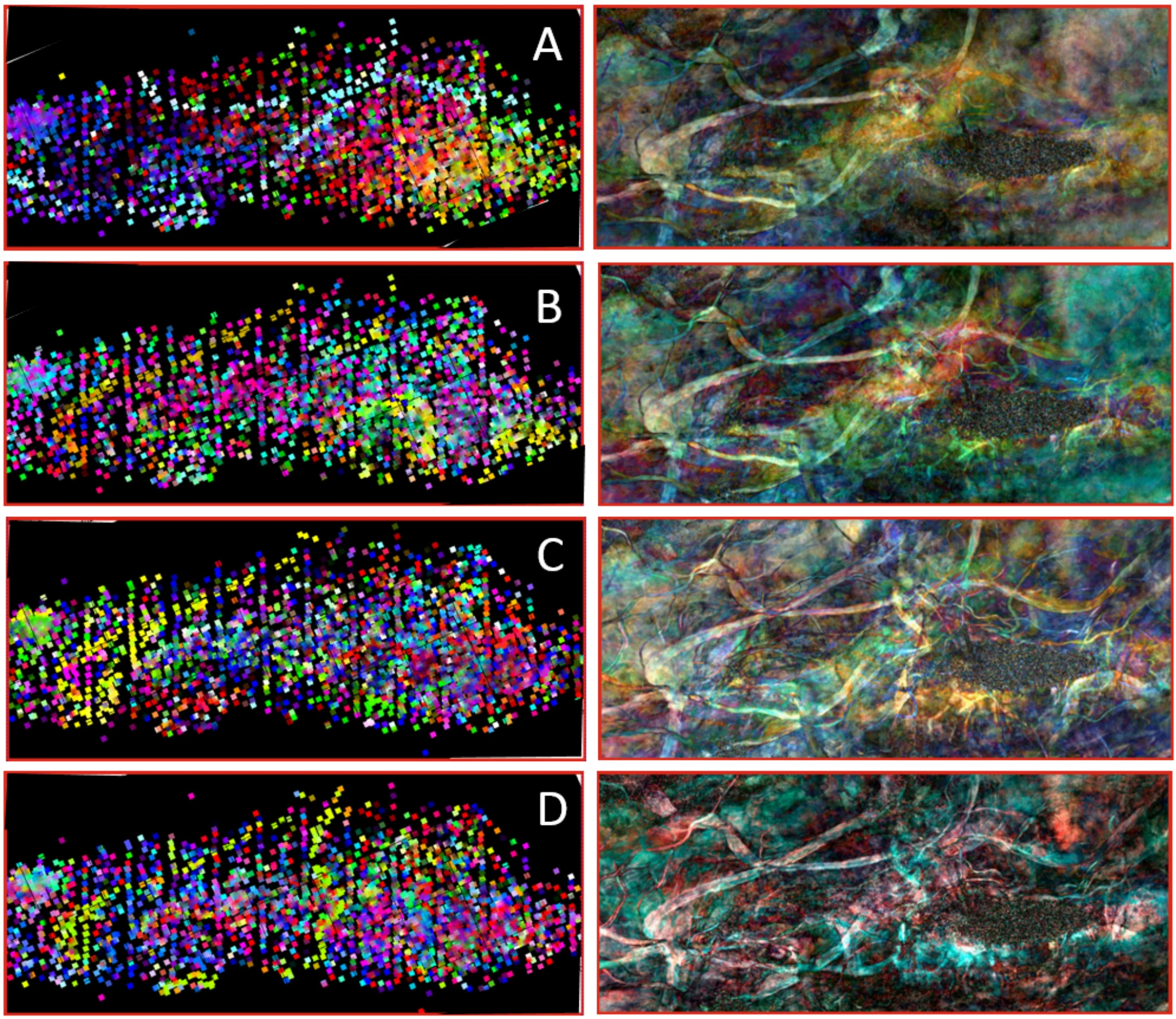
Well log classification results for four mapped intervals, together with corresponding spectral decomposition maps
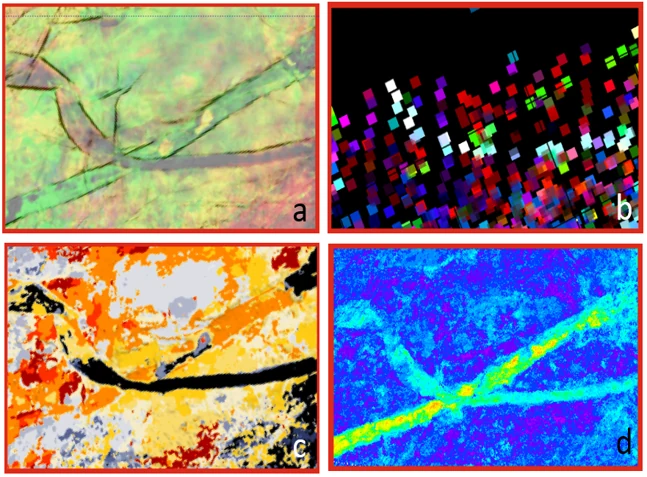
(a) spectral decomposition (b) well log classification (c) seismic facies map (d) porosity map
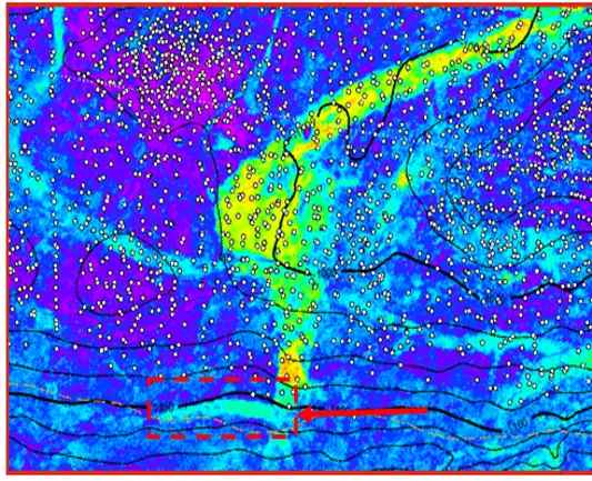
Porosity map fragment with a bypassed reservoir